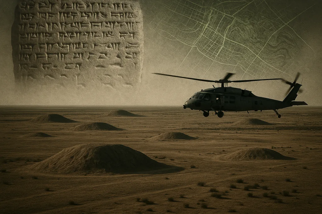
When ancient texts point to places that vanish
On 27 December 2025 a survey of outstanding archaeological mysteries reminded the field — and the public — that some of the Bronze Age and early Iron Age world’s most important cities are still missing from the map. Scholars can name these places from royal inscriptions, administrative tablets and classical authors, but fieldwork and controlled excavation have not yet confirmed their locations. The result is a list of six cities whose absence matters for how we understand early empire, migration and statecraft across Egypt and Mesopotamia.
Lost capitals of the Near East
The six sites most often highlighted in recent accounts are Irisagrig, Itjtawy, Akkad, Al‑Yahudu, Waššukanni and Thinis. Each is missing for a different set of archaeological and modern reasons: some are known only because tablets and inscriptions mention them, others were once central seats of state but now lie under shifting rivers, modern towns or ploughed fields. The patchwork of evidence — looted cuneiform tablets, stelae, chronicle entries and place‑names recorded by ancient historians — gives archaeologists a general region for many of these sites, but not the tell that would let them test hypotheses with stratified excavation.
Irisagrig and looted archives
Irisagrig is a particularly concrete example of how modern looting can freeze archaeological knowledge. Thousands of cuneiform tablets that have circulated on the antiquities market since the early 2000s contain administrative records, festival lists and references to local institutions such as a Temple of Enki. The content makes clear Irisagrig flourished around 4,000 years ago somewhere in what is now Iraq — but because most of the tablets were removed by looters rather than published in the context of controlled excavations, their findspot remains secret. Archival projects and repatriation efforts have returned some tablets to Iraq, and specialists have catalogued and published portions of the corpus, but the hard problem remains: only the looters know the exact mound. The Hobby Lobby case and other high‑profile seizures illustrated both the scientific value of those tablets and the ethical complications of studying material whose recovery was illicit.
Egypt's invisible capitals
Al‑Yahudu: exile communities without a tell
Al‑Yahudu is known from roughly two hundred Babylonian‑period tablets that document the lives of Judean exiles settled in Babylonia after the fall of Jerusalem in 587 B.C. The tablets give names, economic transactions and place‑names that locate the community in the Tigris‑Euphrates delta region, probably in the orbit of Nippur or Borsippa, but archaeologists lack a securely identified mound. As with Irisagrig, the route by which these texts entered modern collections — and the scarcity of published findspot data — makes field identification difficult.
Why some cities stay hidden
Four common obstacles recur across these cases. First, looting and black‑market dispersal of artifacts remove crucial contextual information: tablets without a recorded findspot are hard to convert into a mapped city. Second, natural processes — river avulsion, alluviation and desertification — can bury or displace the archaeological record. Third, modern development, intensive agriculture or the presence of contemporary towns sit on top of ancient mounds and limit excavation. And fourth, political violence and insecurity — notably in Iraq and Syria since 2003 and the Syrian civil war — have reduced access to fieldwork, accelerated looting and damaged archives that researchers would need to guide searches. UNESCO and field archaeologists continue to sound the alarm about the combined effect of these pressures on heritage.
New tools, renewed hope
Archaeologists are not without recourse. Remote sensing — from declassified Cold War CORONA aerial photos through high‑resolution commercial satellites to airborne and drone‑borne LiDAR — has repeatedly revealed buried city plans or landscape features invisible on the ground. The LiDAR revolution in forested regions, for example, exposed tens of thousands of previously unrecorded Maya structures in Guatemala and has redefined expectations for discovering large, low‑lying or heavily overgrown urban centres. Similar approaches, combined with GIS modelling of ancient river channels and targeted ground‑truthing, can narrow candidate zones for sites such as Akkad or Itjtawy. The success of these methods depends on open data, secure access for survey teams and cooperation with local authorities.
What finding — or not finding — them would mean
Locating these six cities is not an antiquarian hobby; each city anchors major questions. A confirmed Akkad or Waššukanni would shed light on the territorial reach, administrative systems and inter‑imperial diplomacy of Bronze Age states. Finding Itjtawy or Thinis would clarify how early Egyptian polities reorganised their capitals and how power moved between Upper and Lower Egypt. Irisagrig and Al‑Yahudu, when properly excavated, could transform our picture of provincial economy, religious practice and minority communities in Mesopotamia. Even in the absence of excavation, the surviving tablets and inscriptions already reshape narratives — but controlled archaeological recovery would let scholars test chronologies, craft production, diet and urban form against material evidence rather than text alone.
Where the search goes next
Expect a two‑track effort. Remote sensing and landscape modelling will continue to reduce large search areas to smaller, testable targets; where security permits, short, tightly focused excavations or coring programs will evaluate those targets. International collaboration, transparent publication of looted collections’ provenances, and greater investment in regional heritage capacity are also essential: without them, even the most promising satellite image can lead nowhere. The story of these lost cities is therefore not just about stones and tablets, but about who controls knowledge, who protects it and how science proceeds under difficult political conditions.
Sources
- Journal of Abydos (article on Thinis and Abydos region)
- Cuneiform Digital Library Initiative (CDLI) — corpora of Mesopotamian tablets
- British Museum (collections and repatriation records)
- Al‑Rāfidān: Journal of Western Asiatic Studies (scholarship on Akkad and Mesopotamian geography)
- UNESCO (reports on heritage protection and looting in Syria and Iraq)
- Nature (peer‑reviewed studies demonstrating LiDAR’s impact on landscape archaeology)